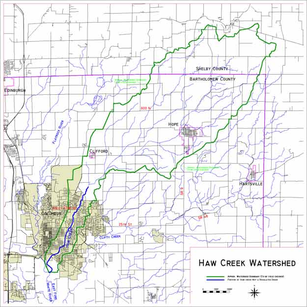
There are 58.3 square miles of area in the Haw Creek watershed beginning in northern Bartholomew County and southern Shelby County. Source: USDA - Natural Resource Conservation Service.
Additional Drainage Area Information from U.S.G.S. Data:
The Flatrock River has a drainage area of about 540 sq. miles. It joins with the Driftwood River west of Columbus to form the East Fork of the White River that, at that point, has a drainage area of 1707 sq. miles. Just downstream from that junction, the Haw Creek with a 58 sq. mile drainage area enters. At Seymour, the East Fork has a drainage area of 2341 sq. miles.
58 of 2341 = 2.5%.
Conclusion: Even major improvement to Haw Creek in Columbus would have little or no impact on the flooding potential at Seymour and could, in fact, decrease the flooding potential in Seymour because of the differences in time of concentration between the East Fork and the Haw Creek.
![]()
![]()
![]()